Single image summary of time-varying Earth-features
Abstract
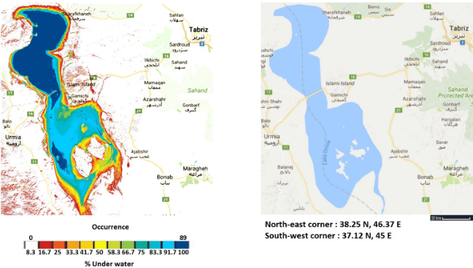
The Earth’s surface is live and dynamic due to natural and manmade events. Tracking and visualizing Earth-features (eg water, snow, and vegetation) is an important problem. Earth observation satellite imagery like Landsat 8 makes the tracking feasible by providing detailed multispectral imagery at regular intervals. In this paper, we explore a single image summary approach to detecting changes in Earth-features by using the Landsat 8 dataset. In our system, we use appropriate thresholds for spectral indices to identify features, reference datasets, and combine multiple images using predefined color palettes to generate a single image summary of features for a region. Furthermore, we illustrate the benefit of our method over traditional visualizations with case-studies for the Lake Urmia, the Amazon Rainforest, and the Bering Glacier.