Illustrating terrains using direction of slope and lighting
Abstract
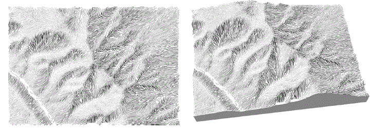
Landscape illustrations and cartographic maps depict ter-rain surface in a qualitatively effective way. In this paper, we present a framework for line drawing techniques for automatically reproducing traditional illustrations of ter-rain by means of slope lines and tonal variations. Given a digital elevation model, surface measures are computed and slope lines of the terrain are hierarchically traced and stored. At run-time slope lines are rendered by stylized procedural and texture-based strokes. The stroke density of the final image is determined according to the light in-tensities. Using a texture based approach, the line draw-ing pipeline is encapsulated from the rendering of the ter-rain geometry. Our system operates on terrain data at in-teractive rates while maintaining frame-to-frame coher-ence. Key words: Terrain visualization, non-photorealistic ren-