Interactive 3D content modeling for digital earth
Abstract
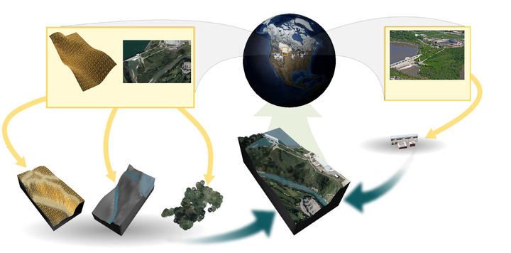
Digital Earth is a global reference model for integrating, processing and visualizing geospatial datasets. In this reference model, various data-types, including Digital Elevation Models (DEM) and imagery (orthophotos), are universally and openly available for the entire globe. However, 3D content such as detailed terrains with features, man-made structures, 3D water bodies and 3D vegetation are not commonly available in Digital Earth. In this paper, we present an interactive system for the rapid creation and integration of these types of 3D content to augment Digital Earth. The inputs to our system include available data sources, such as DEM and imagery information depicting landscapes and urban environments. The proposed system employs sketch-based and image-assisted tools to support interactive creation of textured 3D content. For adding terrain features visible in orthophotos, and also the basin of …
Faramarz F. Samavati
Professor
My research interests include Computer Graphics, Geometric Modeling, Visualization, and Digital Earth.