Geospatial Physicalization in Geography Education
Abstract
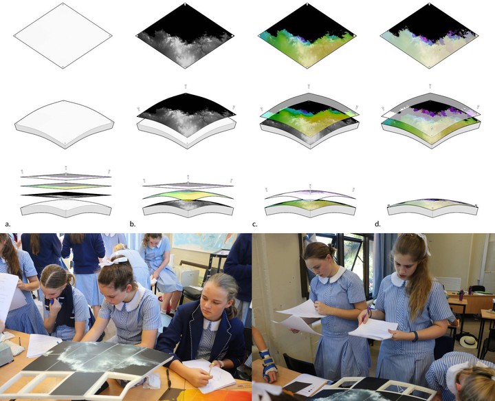
A novel method to create a physicalization of Digital Earth resulted a new type of analogue and tactile geographic information system (GIS). The model was tested by students in Australia, who shared insights into how the model supported their learning about the concept of “overlay” while providing an interesting and engaging learning platform. Observations suggest the model promoted collaborative learning, and provided a bridge between paper maps and digital GIS. This study offers insight into preferences of school children for physicalization models in geography education and contributes to an understanding of children's spatial thinking and understanding of the overlay concept.
Type
Publication
Journal of Geography