A New Dissimilarity Metric for Anomaly Detection in Management Zones Delineation Constructed from Time-Varying Satellite Images
Abstract
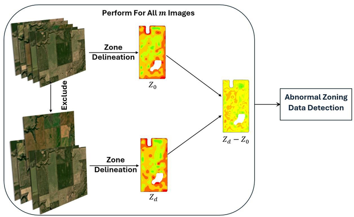
A field’s historical performance data are used for management zone delineation in precision agriculture, but including abnormal data leads to inappropriate zones. This paper introduces a framework incorporating historical performance data and a new Zoning Dissimilarity Metric (𝑍𝐷𝑀 ) to detect abnormal zoning data automatically. The methodology identifies abnormal zoning data among the field’s performance indicators extracted from satellite images to enhance the accuracy of the delineated zones. We experimented with our framework using Sentinel-2 images on 39 fields across Canada. Our experimental results, which involve both real and synthetic data, clearly demonstrate the importance of 𝑍𝐷𝑀 in effectively excluding abnormal data during the zone delineation process.
Roghayeh Heidari
Ph.D. Candidate
September 2021 - present
Roghi is a PhD student interested in computer graphics, and algorithm design.