Real-Time Multiresolution Management of Spatiotemporal Earth Observation Data Using DGGS
Abstract
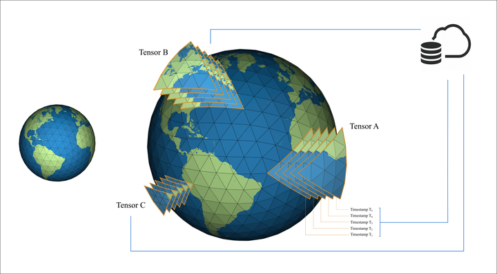
The effective management of spatiotemporal Earth observation data is a significant challenge due to their growing size and scale, geometric distortion, temporal gaps, and restricted access. In this article, we introduce a novel methodology utilizing a Discrete Global Grid System (DGGS) to address a set of challenges related to spatiotemporal data storage with a live updating mechanism, the multiresolution processing of an arbitrary region of interest (ROI) in real time, and the approximation of missing data in a smooth, continuous manner. We use reverse Chaikin subdivision and B-spline curve fitting to handle temporal data gaps, allowing for real-time updates. Additionally, our work presents a triangular wavelet scheme to incorporate a flexible, tensor-based multiresolution storage scheme for spatiotemporal raster data. The case study we present uses data from the RADARSAT Constellation Mission (RCM) of the Canadian Space Agency (CSA). Our system enables the dynamic retrieval and visualization of time-varying data for a user-defined ROI. The obtained results demonstrate that our method ensures high data fidelity while making spatiotemporal data more accessible across various practical applications in Earth observation.
Amir Mirzai Golpayegani
Alumni M.Sc. Student
September 2022 - February 2026
Amir Mirzai is an MSc student interested in Digital Earth.