Remote Sensing in Precision Agriculture
Introduction
The increasing demand for food coupled with the impacts of climate change underscores the importance of making informed decisions in agriculture. Precision agriculture leverages advanced technologies to optimize field management. Because factors like the shape of the land, soil type, and weather can change a lot within a single field, we need tailored management strategies.
Objectives
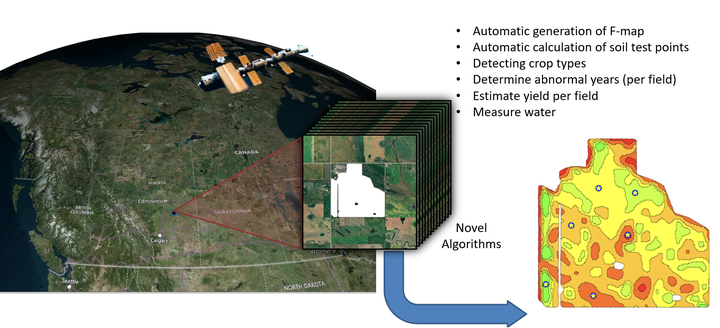
Our team uses long-term, time-varying satellite data to algorithmically:
- Create Fertility Maps (FMAP) for given fields
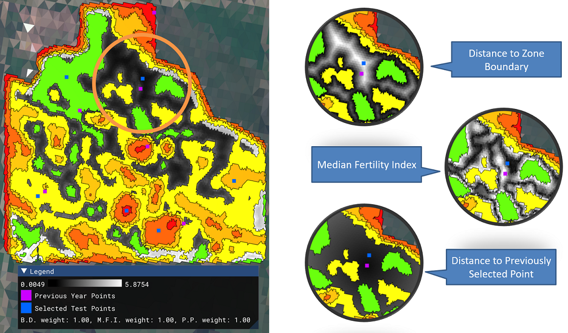
- Determine the best locations for soil testing
- Early detect crop types for large regions
- Identify abnormal datasets across years and regions
- Estimate yield for given fields
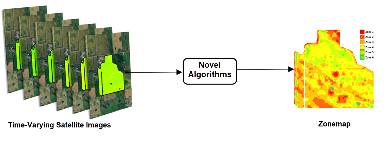
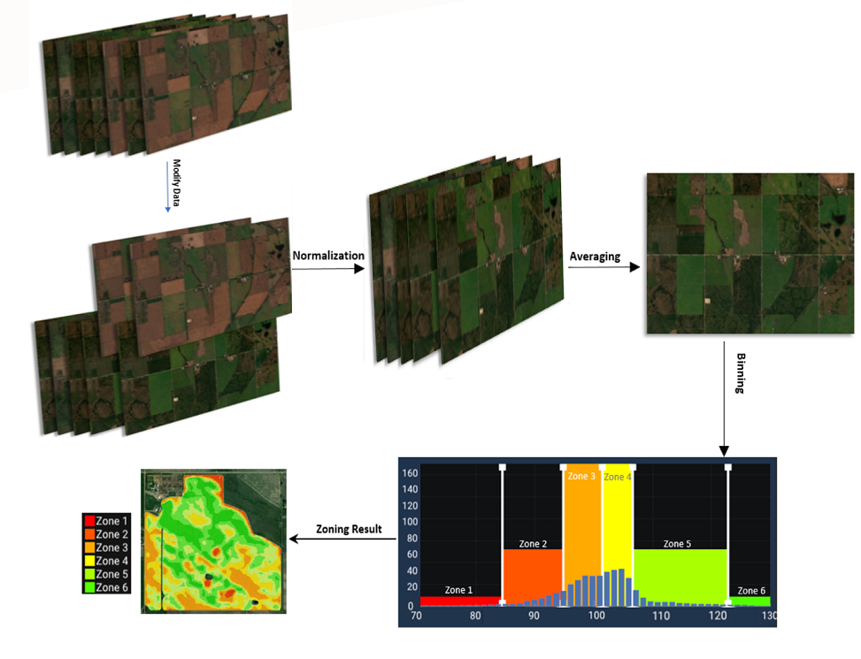
The data from Sentinel 2 satellite is utilized to calculate a metric (performance index) which is described based on the vegetation index as an indicator of the quality of the soil and crop. When the greenness and healthiness of vegetation, in the peak time, is high, the soil is performing well. The available historical images of the field are used to get an aggregation about the performance of the soil and segment the field into different zones. In this visualization, we have used the colormap to show better zones (green) vs weaker zones (red).
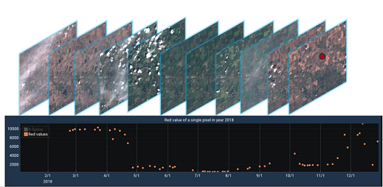
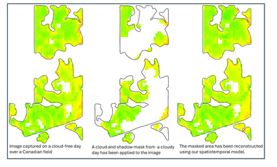
How to handle the missing data, cloud and shadows?
How to find the optimised soil test points in the farm field automatically?
How to find the the anomaly in the historical performance data of the field algorithmically?
Research and Development in Remote Sensing for Precision Agriculture
Dr. Samavati’s team has been very active in the research and development in precision agriculture to find the answers for above questions and many others including crop type classification and yield estimation. New methods and algorithms in computer vision, machine learning, and deep learning have been utilized and several peer reviewed papers have been published or are under review in this area.
Faramarz F. Samavati
Professor
My research interests include Computer Graphics, Geometric Modeling, Visualization, and Digital Earth.
Publications
Assessing Surface Water Dynamics of Wetlands in Reclaimed Mining Areas in the Athabasca Oil Sands Region, Alberta, Canada, with Time-Varying Sentinel-1 SAR and Sentinel-2 Multi-Spectral Imagery (2025)

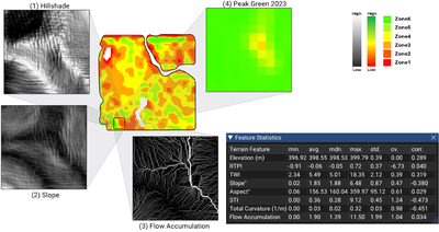
Terrain Matters: A Focus+Context Visualization Approach for Landform-Based Remote Sensing Analysis of Agricultural Performance (2025)
Distance Transform-Based Spatiotemporal Model for Approximating Missing NDVI from Satellite Data (2025)
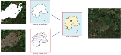
Variational-Based Spatial–Temporal Approximation of Images in Remote Sensing (2024)
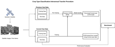
Evaluation of Data Sufficiency for Interannual Knowledge Transfer of Crop Type Classification Models (2024)
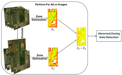
A New Dissimilarity Metric for Anomaly Detection in Management Zones Delineation Constructed from Time-Varying Satellite Images (2024)
Automatic Soil Sampling Site Selection in Management Zones Using a Multi-Objective Optimization Algorithm (2023)

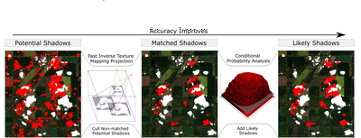
Cloud Shadow Detection via Ray Casting with Probability Analysis Refinement Using Sentinel-2 Satellite Data (2023)
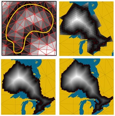
Efficient Calculation of Distance Transform on Discrete Global Grid Systems (2022)